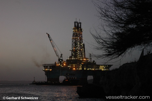
Maersk Developer
Current StatusWhere is the vessel?
Maersk Developer is currently in 99 nm SE of Arembepe, based on AIS data received about 812d ago.
Latest AIS update:
Current position: 13.99922° S, 37.05550° W (99 nm SE of Arembepe)
Average speed (last 7 days): Loading…
Average speed (last 30 days): Loading…
Vessel profile: Maersk Developer is a Drilling Ship with dimensions 78m x 117m.
This page combines live AIS, route history, probable destination signals, nearby traffic, and port activity for practical vessel monitoring.
The current position of vessel Maersk Developer is -13.99922 lat / -37.05550 lng. Updated: 2024-02-28 18:31:10 UTCDetails:
Live Vessel Maersk Developer Analytics (details, animations, etc.)
Recent AIS points (UTC):
2024-02-28 18:31:10 UTC · -13.99922, -37.05550 · SOG 0 kn · COG 0°