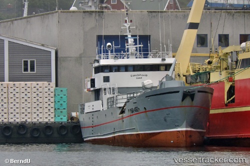
Sandshavid
Current StatusWhere is the vessel?
Sandshavid is currently in Near SANDUR, based on AIS data received about 1247d ago.
Latest AIS update:
Current position: 61.82833° N, 6.80915° W (Near SANDUR)
Average speed (last 7 days): Loading…
Average speed (last 30 days): Loading…
Vessel profile: Sandshavid is a Fish Carrier with dimensions 8m x 33m.
This page combines live AIS, route history, probable destination signals, nearby traffic, and port activity for practical vessel monitoring.
The current position of vessel Sandshavid is 61.82833 lat / -6.80915 lng. Updated: 2022-12-20 16:40:38 UTCNearest reference points:
- Near FUGLAFJORDUR
- Near VESTMANNA
- 20 nm S of Vágur
Details:
Live Vessel Sandshavid Analytics (details, animations, etc.)
Recent AIS points (UTC):
2022-12-20 16:40:38 UTC · 61.82833, -6.80915 · SOG 0 kn · COG 219°