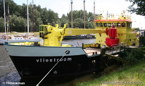
 VLIESTROOM
Current Status
Where is the vessel?
VLIESTROOM is currently in Near S GRAVENDEEL, based on AIS data received about 15h ago.
Latest AIS update:
Current position: 51.78805° N, 4.62994° E (Near S GRAVENDEEL)
Average speed (last 7 days): Loading…
Average speed (last 30 days): Loading…
Vessel profile: VLIESTROOM is a Tender with dimensions m x m.
This page combines live AIS, route history, probable destination signals, nearby traffic, and port activity for practical vessel monitoring.
The current position of vessel VLIESTROOM is 51.78805 lat / 4.62994 lng. Updated: 2026-05-20 19:03:10 UTCNearest reference points:
- Near Mookhoek
- Near STRIJENSAS
- Near Puttershoek
Currently sailing under the flag of Netherlands ![]()
Details:
Live Vessel VLIESTROOM Analytics (details, animations, etc.)
Recent AIS points (UTC):
2026-05-20 16:25:20 UTC · 51.78805, 4.62993 · SOG 0 kn · COG 22°2026-05-20 16:25:20 UTC · 51.78805, 4.62993 · SOG 0 kn · COG 22°
2026-05-20 17:37:18 UTC · 51.78805, 4.62994 · SOG 0 kn · COG 22°
2026-05-20 19:03:10 UTC · 51.78805, 4.62994 · SOG 0 kn · COG 22°