Tanto Lestari
Current StatusWhere is the vessel?
Tanto Lestari is currently in 70 nm NE of Piru, based on AIS data received about 20h ago.
Latest AIS update:
Current position: 1.99783° S, 128.66785° E (70 nm NE of Piru)
Average speed (last 7 days): Loading…
Average speed (last 30 days): Loading…
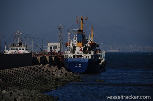
Vessel profile: Tanto Lestari is a Container Ship with dimensions 20m x 124m.
This page combines live AIS, route history, probable destination signals, nearby traffic, and port activity for practical vessel monitoring.
The current position of vessel Tanto Lestari is -1.99783 lat / 128.66785 lng. Updated: 2026-05-24 19:42:28 UTCNearest reference points:
- 55 nm S of Labuha, Molucas
- Near Ambon
- 60 nm W of Sorong
Details:
Live Vessel Tanto Lestari Analytics (details, animations, etc.)
Recent AIS points (UTC):
2026-05-24 19:42:28 UTC · -1.99783, 128.66785 · SOG 14 kn · COG -1°2026-05-24 19:42:28 UTC · -1.99783, 128.66785 · SOG 14 kn · COG -1°
2026-05-24 19:42:28 UTC · -1.99783, 128.66785 · SOG 14 kn · COG -1°
2026-05-24 19:42:28 UTC · -1.99783, 128.66785 · SOG 14 kn · COG -1°