 vesseltracker.com
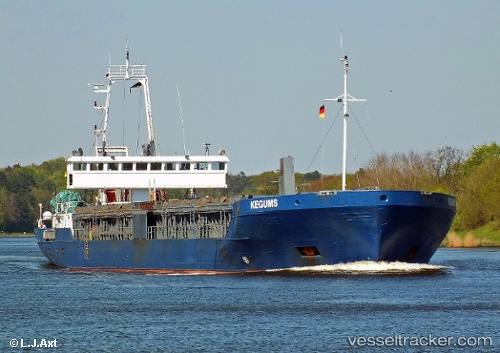
 Kegums
Current Status
Where is the vessel?
Kegums is currently in Near Namsos, based on AIS data received about 1h ago.
Latest AIS update:
Current position: 64.45955° N, 11.50044° E (Near Namsos)
Average speed (last 7 days): Loading…
Average speed (last 30 days): Loading…
Vessel profile: Kegums is a General Cargo Ship with dimensions 104m x 104m.
This page combines live AIS, route history, probable destination signals, nearby traffic, and port activity for practical vessel monitoring.
The current position of vessel Kegums is 64.45955 lat / 11.50044 lng. Updated: 2026-03-30 10:02:15 UTCNearest reference points:
- Near Utvorda
- Near Vingsand
- Near Leksvik
Currently sailing under the flag of Norway ![]()
Kegums built in 1989 year
Deadweight:
4225 tDetails:
Live Vessel Kegums Analytics (details, animations, etc.)
Recent AIS points (UTC):
2026-03-30 03:44:11 UTC · 64.45959, 11.50036 · SOG 0 kn · COG 145°2026-03-30 05:23:14 UTC · 64.45956, 11.50041 · SOG 0 kn · COG 145°
2026-03-30 07:59:14 UTC · 64.45956, 11.50042 · SOG 0 kn · COG 145°
2026-03-30 10:02:15 UTC · 64.45955, 11.50044 · SOG 0 kn · COG 145°