 vesseltracker.com
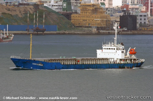
Anita
Current StatusWhere is the vessel?
Anita is currently in 11 nm W of LATAKIA, based on AIS data received about 1h ago.
Latest AIS update:
Current position: 35.54260° N, 35.53878° E (11 nm W of LATAKIA)
Average speed (last 7 days): Loading…
Average speed (last 30 days): Loading…
Vessel profile: Anita is a Aggregates Carrier with dimensions 15m x 89m.
This page combines live AIS, route history, probable destination signals, nearby traffic, and port activity for practical vessel monitoring.
The current position of vessel Anita is 35.54260 lat / 35.53878 lng. Updated: 2026-05-14 07:26:10 UTCNearest reference points:
- Near Al Latakia
- Near Al Ladhiqiyah
- Near Tartous
Details:
Live Vessel Anita Analytics (details, animations, etc.)
Recent AIS points (UTC):
2026-05-13 21:14:09 UTC · 35.53528, 35.73331 · SOG 0.4 kn · COG 335°2026-05-14 05:57:22 UTC · 35.53460, 35.73316 · SOG 1.2 kn · COG 207°
2026-05-14 07:23:10 UTC · 35.54313, 35.54585 · SOG 6.8 kn · COG 264°
2026-05-14 07:26:10 UTC · 35.54260, 35.53878 · SOG 6.7 kn · COG 259°