 MERT L
Current Status
Where is the vessel?
MERT L is currently in 46 nm N of Cide, based on AIS data received about 15h ago.
Latest AIS update:
Current position: 42.65190° N, 32.81244° E (46 nm N of Cide)
Average speed (last 7 days): Loading…
Average speed (last 30 days): Loading…
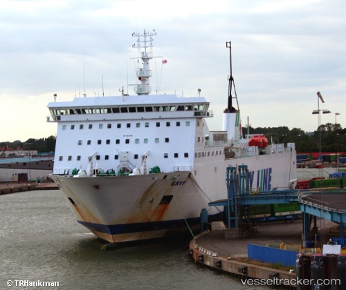
Vessel profile: MERT L is a Ro-Ro/Passenger Ship with dimensions m x m.
This page combines live AIS, route history, probable destination signals, nearby traffic, and port activity for practical vessel monitoring.
The current position of vessel MERT L is 42.65190 lat / 32.81244 lng. Updated: 2026-06-30 02:26:20 UTCNearest reference points:
- 27 nm NW of INEBOLU
- Near Cide
- 18 nm NW of INEBOLU
Currently sailing under the flag of Cameroon ![]()
Details:
Live Vessel MERT L Analytics (details, animations, etc.)
Recent AIS points (UTC):
2026-06-29 22:29:50 UTC · 42.55942, 33.84803 · SOG 11.7 kn · COG 275°2026-06-29 23:34:00 UTC · 42.58238, 33.56590 · SOG 11.6 kn · COG 275°
2026-06-30 01:03:22 UTC · 42.61647, 33.17682 · SOG 11.7 kn · COG 275°
2026-06-30 02:26:20 UTC · 42.65190, 32.81244 · SOG 11.6 kn · COG 275°