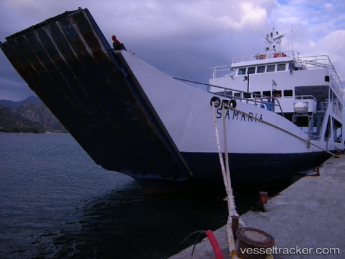
 Samaria Ib
Current Status
Where is the vessel?
Samaria Ib is currently in Near SFAKIA, based on AIS data received about 15h ago.
Latest AIS update:
Current position: 35.19667° N, 24.13667° E (Near SFAKIA)
Average speed (last 7 days): Loading…
Average speed (last 30 days): Loading…
Vessel profile: Samaria Ib is a Passenger Ro Ro Cargo Ship with dimensions 46m x 12m.
This page combines live AIS, route history, probable destination signals, nearby traffic, and port activity for practical vessel monitoring.
The current position of vessel Samaria Ib is 35.19667 lat / 24.13667 lng. Updated: 2026-05-27 23:28:47 UTCNearest reference points:
- Near Kali Limenes
- Near Iraklion
- 67 nm S of Kali Limenes
Currently sailing under the flag of Greece ![]()
Samaria Ib built in 1986 year
Deadweight:
115 tDetails:
Live Vessel Samaria Ib Analytics (details, animations, etc.)
Recent AIS points (UTC):
2026-05-27 18:02:51 UTC · 35.19813, 24.13730 · SOG 0 kn · COG -1°2026-05-27 18:02:51 UTC · 35.19813, 24.13730 · SOG 0 kn · COG -1°
2026-05-27 22:28:48 UTC · 35.19667, 24.13667 · SOG 0 kn · COG -1°
2026-05-27 23:28:47 UTC · 35.19667, 24.13667 · SOG 0 kn · COG -1°