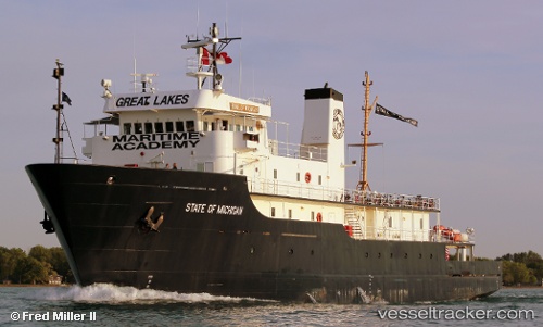
State Of Michigan
Current StatusWhere is the vessel?
State Of Michigan is currently in Near Port Huron, based on AIS data received about 15h ago.
Latest AIS update:
Current position: 42.95856° N, 82.42677° W (Near Port Huron)
Average speed (last 7 days): Loading…
Average speed (last 30 days): Loading…
Vessel profile: State Of Michigan is a Training Ship with dimensions 13m x 68m.
This page combines live AIS, route history, probable destination signals, nearby traffic, and port activity for practical vessel monitoring.
The current position of vessel State Of Michigan is 42.95856 lat / -82.42677 lng. Updated: 2026-05-27 08:05:25 UTCNearest reference points:
- Near Fort Gratiot
- Near Saint Clair Shores
- Near Walkerville
Details:
Live Vessel State Of Michigan Analytics (details, animations, etc.)
Recent AIS points (UTC):
2026-05-27 04:51:34 UTC · 42.95833, -82.42667 · SOG 0 kn · COG -1°2026-05-27 06:08:26 UTC · 42.95856, -82.42673 · SOG 0 kn · COG 29°
2026-05-27 07:08:22 UTC · 42.95855, -82.42675 · SOG 0 kn · COG 29°
2026-05-27 08:05:25 UTC · 42.95856, -82.42677 · SOG 0 kn · COG 29°