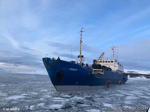
 Pomor
Pomor
Current Status
Where is the vessel?
Pomor is currently in 207 nm NW of Matochkin Shar, based on AIS data received about 14h ago.
Latest AIS update:
Current position: 75.75375° N, 45.23396° E (207 nm NW of Matochkin Shar)
Average speed (last 7 days): Loading…
Average speed (last 30 days): Loading…
Vessel profile: Pomor is a Fish Carrier with dimensions 85m x 86m.
This page combines live AIS, route history, probable destination signals, nearby traffic, and port activity for practical vessel monitoring.
The current position of vessel Pomor is 75.75375 lat / 45.23396 lng. Updated: 2026-05-19 01:19:33 UTCNearest reference points:
- 223 nm NW of Matochkin Shar
Currently sailing under the flag of Russia ![]()
Details:
Live Vessel Pomor Analytics (details, animations, etc.)
Recent AIS points (UTC):
2026-05-18 22:26:15 UTC · 75.84433, 44.75962 · SOG 2.4 kn · COG 25°2026-05-18 23:39:05 UTC · 75.81705, 44.93611 · SOG 3.6 kn · COG 137°
2026-05-19 00:48:29 UTC · 75.77229, 45.14011 · SOG 3.5 kn · COG 133°
2026-05-19 01:19:33 UTC · 75.75375, 45.23396 · SOG 3.6 kn · COG 126°