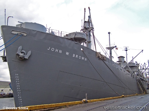
 John W Brown
Current Status
Where is the vessel?
John W Brown is currently in Near Baltimore, based on AIS data received about 14h ago.
Latest AIS update:
Current position: 39.25945° N, 76.55616° W (Near Baltimore)
Average speed (last 7 days): Loading…
Average speed (last 30 days): Loading…
Vessel profile: John W Brown is a General Cargo Ship with dimensions 128m x 19m.
This page combines live AIS, route history, probable destination signals, nearby traffic, and port activity for practical vessel monitoring.
The current position of vessel John W Brown is 39.25945 lat / -76.55616 lng. Updated: 2026-06-03 13:54:04 UTCNearest reference points:
- Near Baltimore
- Near DUNDALK
- Near South Baltimore
Currently sailing under the flag of USA ![]()
Details:
Live Vessel John W Brown Analytics (details, animations, etc.)
Recent AIS points (UTC):
2026-06-03 10:06:01 UTC · 39.25950, -76.55608 · SOG 0 kn · COG -1°2026-06-03 10:30:02 UTC · 39.25939, -76.55607 · SOG 0 kn · COG -1°
2026-06-03 13:51:03 UTC · 39.25947, -76.55607 · SOG 0 kn · COG -1°
2026-06-03 13:54:04 UTC · 39.25945, -76.55616 · SOG 0 kn · COG -1°