 vesseltracker.com
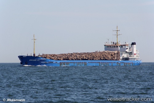
 OMSKIY 137
Current Status
Where is the vessel?
OMSKIY 137 is currently in 24 nm NW of UNYE, based on AIS data received about 3h ago.
Latest AIS update:
Current position: 41.45912° N, 37.06413° E (24 nm NW of UNYE)
Average speed (last 7 days): Loading…
Average speed (last 30 days): Loading…
Vessel profile: OMSKIY 137 is a General Cargo Ship with dimensions 109m x 15m.
This page combines live AIS, route history, probable destination signals, nearby traffic, and port activity for practical vessel monitoring.
The current position of vessel OMSKIY 137 is 41.45912 lat / 37.06413 lng. Updated: 2026-05-14 04:20:20 UTCNearest reference points:
- 15 nm W of UNYE
- Near Samsun
- Near Fatsa
Currently sailing under the flag of Russia ![]()
OMSKIY 137 built in 1988 year
Deadweight:
3029 tDetails:
Live Vessel OMSKIY 137 Analytics (details, animations, etc.)
Recent AIS points (UTC):
2026-05-14 04:20:20 UTC · 41.45912, 37.06413 · SOG 7.8 kn · COG 120°2026-05-14 04:20:20 UTC · 41.45912, 37.06413 · SOG 7.8 kn · COG 120°
2026-05-14 04:20:20 UTC · 41.45912, 37.06413 · SOG 7.8 kn · COG 120°
2026-05-14 04:20:20 UTC · 41.45912, 37.06413 · SOG 7.8 kn · COG 120°