 vesseltracker.com
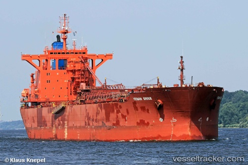
 Yeoman Bridge
Current Status
Where is the vessel?
Yeoman Bridge is currently in Near Kilchoan, based on AIS data received about 1h ago.
Latest AIS update:
Current position: 56.69150° N, 6.23975° W (Near Kilchoan)
Average speed (last 7 days): Loading…
Average speed (last 30 days): Loading…
Vessel profile: Yeoman Bridge is a Self Discharging Bulk Carrier with dimensions 250m x 249m.
This page combines live AIS, route history, probable destination signals, nearby traffic, and port activity for practical vessel monitoring.
The current position of vessel Yeoman Bridge is 56.69150 lat / -6.23975 lng. Updated: 2026-05-14 07:23:25 UTCNearest reference points:
- Near Fishnish, Isle of Mull
- Near CRAIGNURE PIER
- Near KYLE OF LOCHALSH
Currently sailing under the flag of Bahamas ![]()
Yeoman Bridge built in 1991 year
Deadweight:
96772 tDetails:
Live Vessel Yeoman Bridge Analytics (details, animations, etc.)
Recent AIS points (UTC):
2026-05-14 04:13:47 UTC · 57.29424, -6.87669 · SOG 13.1 kn · COG 159°2026-05-14 06:20:46 UTC · 56.87992, -6.49646 · SOG 13.4 kn · COG 137°
2026-05-14 07:02:27 UTC · 56.75561, -6.32425 · SOG 13.5 kn · COG 140°
2026-05-14 07:23:25 UTC · 56.69150, -6.23975 · SOG 14 kn · COG 139°