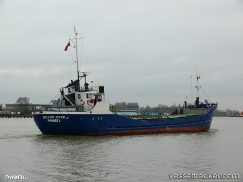
Mv Simore
Current StatusWhere is the vessel?
Mv Simore is currently in 40 nm NW of Gagak Rimang Fso, based on AIS data received about 14h ago.
Latest AIS update:
Current position: 6.17803° S, 111.79021° E (40 nm NW of Gagak Rimang Fso)
Average speed (last 7 days): Loading…
Average speed (last 30 days): Loading…
Vessel profile: Mv Simore is a General Cargo Ship with dimensions 18m x 99m.
This page combines live AIS, route history, probable destination signals, nearby traffic, and port activity for practical vessel monitoring.
The current position of vessel Mv Simore is -6.17803 lat / 111.79021 lng. Updated: 2026-06-13 11:47:43 UTCNearest reference points:
- 68 nm NW of Gagak Rimang Fso
- 49 nm NE of TANJUNG JATI
- 13 nm NW of Palang
Details:
Live Vessel Mv Simore Analytics (details, animations, etc.)
Recent AIS points (UTC):
2026-06-13 09:33:37 UTC · -6.11734, 112.10402 · SOG 8.8 kn · COG -1°2026-06-13 09:33:37 UTC · -6.11734, 112.10402 · SOG 8.8 kn · COG -1°
2026-06-13 11:47:43 UTC · -6.17803, 111.79021 · SOG 8.5 kn · COG -1°
2026-06-13 11:47:43 UTC · -6.17803, 111.79021 · SOG 8.5 kn · COG -1°