 vesseltracker.com
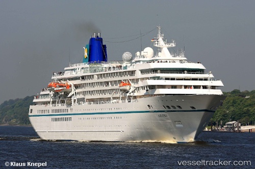
 Amadea
Current Status
Where is the vessel?
Amadea is currently in Near Lanzarote, based on AIS data received about 14h ago.
Latest AIS update:
Current position: 28.96602° N, 13.53315° W (Near Lanzarote)
Average speed (last 7 days): Loading…
Average speed (last 30 days): Loading…
Vessel profile: Amadea is a Cruise Ship with dimensions 192m x 28m.
This page combines live AIS, route history, probable destination signals, nearby traffic, and port activity for practical vessel monitoring.
The current position of vessel Amadea is 28.96602 lat / -13.53315 lng. Updated: 2026-05-18 10:07:12 UTCNearest reference points:
- Near Lanzarote
- Near LAS COLORADAS
- 56 nm NW of Caleta de Sebo
Currently sailing under the flag of Bahamas ![]()
Amadea built in 1991 year
Deadweight:
3938 tDetails:
Live Vessel Amadea Analytics (details, animations, etc.)
Recent AIS points (UTC):
2026-05-18 07:22:10 UTC · 28.96600, -13.53316 · SOG 0 kn · COG 29°2026-05-18 08:19:05 UTC · 28.96601, -13.53316 · SOG 0 kn · COG 29°
2026-05-18 09:40:51 UTC · 28.96500, -13.53167 · SOG 0 kn · COG -1°
2026-05-18 10:07:12 UTC · 28.96602, -13.53315 · SOG 0 kn · COG 29°