 Omega Star
Current Status
Where is the vessel?
Omega Star is currently in Near MIDIA, based on AIS data received about 14h ago.
Latest AIS update:
Current position: 44.33907° N, 28.67778° E (Near MIDIA)
Average speed (last 7 days): Loading…
Average speed (last 30 days): Loading…
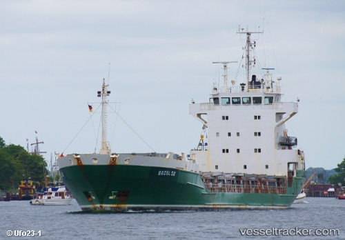
Vessel profile: Omega Star is a Multi Purpose Carrier with dimensions 104m x 16m.
This page combines live AIS, route history, probable destination signals, nearby traffic, and port activity for practical vessel monitoring.
The current position of vessel Omega Star is 44.33907 lat / 28.67778 lng. Updated: 2026-05-19 23:40:46 UTCNearest reference points:
- Near MIDIA
- Near Constanta
- Near Ovidiu
Currently sailing under the flag of Sierra Leone ![]()
Omega Star built in 1991 year
Deadweight:
4454 tDetails:
Live Vessel Omega Star Analytics (details, animations, etc.)
Recent AIS points (UTC):
2026-05-19 20:11:05 UTC · 44.33892, 28.67776 · SOG 0.2 kn · COG 180°2026-05-19 21:59:35 UTC · 44.33905, 28.67779 · SOG 0 kn · COG 180°
2026-05-19 22:28:48 UTC · 44.33908, 28.67777 · SOG 0 kn · COG 180°
2026-05-19 23:40:46 UTC · 44.33907, 28.67778 · SOG 0 kn · COG 180°