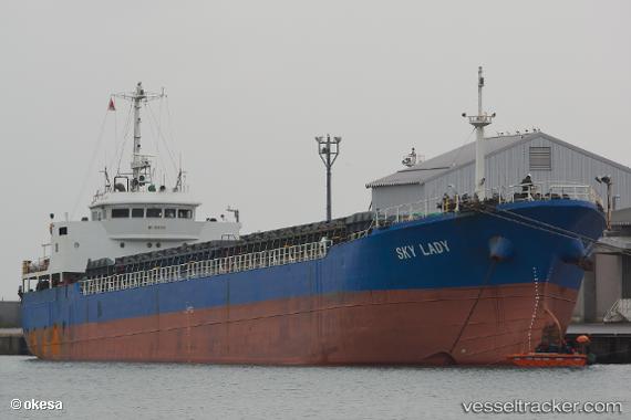
Sky Lady
Current StatusWhere is the vessel?
Sky Lady is currently in 24 nm SW of PAENGMOG, based on AIS data received about 14h ago.
Latest AIS update:
Current position: 34.07167° N, 125.83167° E (24 nm SW of PAENGMOG)
Average speed (last 7 days): Loading…
Average speed (last 30 days): Loading…
Vessel profile: Sky Lady is a General Cargo Ship with dimensions 14m x 90m.
This page combines live AIS, route history, probable destination signals, nearby traffic, and port activity for practical vessel monitoring.
The current position of vessel Sky Lady is 34.07167 lat / 125.83167 lng. Updated: 2026-05-20 13:53:16 UTCNearest reference points:
- 17 nm W of Chuja
- 13 nm NW of Aewol
- Near Galdoo
Details:
Live Vessel Sky Lady Analytics (details, animations, etc.)
Recent AIS points (UTC):
2026-05-20 10:11:38 UTC · 34.50029, 125.44618 · SOG 9.2 kn · COG 153°2026-05-20 10:56:15 UTC · 34.38833, 125.49500 · SOG 9 kn · COG -1°
2026-05-20 13:20:15 UTC · 34.07500, 125.73833 · SOG 8 kn · COG -1°
2026-05-20 13:53:16 UTC · 34.07167, 125.83167 · SOG 8 kn · COG -1°