.
Vessel photo of KAMBUR (IMO 8943600) vesseltracker.com

FR flag KAMBUR

Vessel type: Fishing Vessel | IMO: 8943600 | MMSI: MMSI: 231795000
Call sign: OW2115 | Dimensions: 45 m x 12 m
Current Status

Where is the vessel?

KAMBUR is currently in 20 nm S of Vágur, based on AIS data received about 778d ago.

Latest AIS update:

Current position: 61.13365° N, 6.92003° W (20 nm S of Vágur)

Average speed (last 7 days): Loading…

Average speed (last 30 days): Loading…

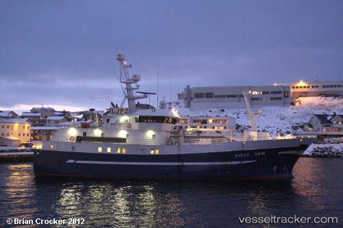
Vessel profile: KAMBUR is a Fishing Vessel with dimensions 45m x 12m.

This page combines live AIS, route history, probable destination signals, nearby traffic, and port activity for practical vessel monitoring.

The current position of vessel KAMBUR is 61.13365 lat / -6.92003 lng. Updated: 2024-02-06 06:56:15 UTC
Nearest reference points:
  • 20 nm S of Vágur
  • Near VESTMANNA
  • Near FUGLAFJORDUR

Currently sailing under the flag of Faroe Islands FR flag

KAMBUR built in 1998 year

Deadweight:
0 t

Details:

Live Vessel KAMBUR Analytics (details, animations, etc.)


Recent AIS points (UTC):
2024-02-06 06:56:15 UTC · 61.13365, -6.92003 · SOG 1.4 kn · COG -1°

Track of the vessel in the last 28 days


UTC: --
Start: -- Track timeline (UTC) End: --
Encountered: --


Link to the map:


Find another ship

KAMBUR (231795000) last ports (portcalls and passsages)

Torshavn | 2024-01-28 06:38:47
Thorshavn | 2024-01-27 09:09:51
Torshavn | 2023-11-03 21:23:22
Torshavn | 2023-10-28 11:57:44
Seydhisfjordhur | 2023-10-11 12:25:57
Sorvagur | 2023-10-04 00:05:23
Torshavn | 2023-10-03 21:36:28
Torshavn | 2023-09-29 02:32:22
Sorvagur | 2023-09-20 23:08:43
Torshavn | 2023-08-29 18:39:17
Torshavn | 2023-07-27 08:50:55
Klaksvig | 2023-07-26 01:07:27
Torshavn | 2023-06-26 17:30:27
Torshavn | 2023-06-18 23:08:03
Torshavn | 2023-05-09 23:28:47
Torshavn | 2023-05-03 03:03:45
Torshavn | 2023-03-22 03:08:02
Torshavn | 2023-03-14 02:33:34
Thorshavn | 2023-02-05 12:01:01
Thorshavn | 2023-01-22 20:48:21