 vesseltracker.com
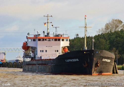
Taganrog
Current StatusWhere is the vessel?
Taganrog is currently in Near Rostov-na-Donu, based on AIS data received about 1h ago.
Latest AIS update:
Current position: 47.20880° N, 39.71625° E (Near Rostov-na-Donu)
Average speed (last 7 days): Loading…
Average speed (last 30 days): Loading…
Vessel profile: Taganrog is a Multi Purpose Carrier with dimensions 15m x 108m.
This page combines live AIS, route history, probable destination signals, nearby traffic, and port activity for practical vessel monitoring.
The current position of vessel Taganrog is 47.20880 lat / 39.71625 lng. Updated: 2026-05-14 11:55:14 UTCNearest reference points:
- Near Rostov-na-Donu
- Near Aksay
- Near Azov
Details:
Live Vessel Taganrog Analytics (details, animations, etc.)
Recent AIS points (UTC):
2026-05-12 18:49:09 UTC · 47.20833, 39.71500 · SOG 0 kn · COG -1°2026-05-12 18:49:09 UTC · 47.20833, 39.71500 · SOG 0 kn · COG -1°
2026-05-14 10:04:57 UTC · 47.20880, 39.71623 · SOG 0 kn · COG -1°
2026-05-14 11:55:14 UTC · 47.20880, 39.71625 · SOG 0.1 kn · COG -1°