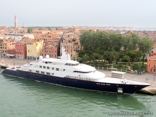
 LIMITLESS
Current Status
Where is the vessel?
LIMITLESS is currently in Near Palma, based on AIS data received about 14h ago.
Latest AIS update:
Current position: 39.56591° N, 2.63902° E (Near Palma)
Average speed (last 7 days): Loading…
Average speed (last 30 days): Loading…
Vessel profile: LIMITLESS is a Yacht with dimensions m x m.
This page combines live AIS, route history, probable destination signals, nearby traffic, and port activity for practical vessel monitoring.
The current position of vessel LIMITLESS is 39.56591 lat / 2.63902 lng. Updated: 2026-06-11 07:52:22 UTCNearest reference points:
- Near Palma
- Near PALMA DE MALLORCA
- Near PORTALS NOUS
Currently sailing under the flag of United States ![]()
Details:
Live Vessel LIMITLESS Analytics (details, animations, etc.)
Recent AIS points (UTC):
2026-06-11 04:37:30 UTC · 39.56589, 2.63900 · SOG 0 kn · COG 232°2026-06-11 06:13:30 UTC · 39.56590, 2.63899 · SOG 0 kn · COG 232°
2026-06-11 07:46:27 UTC · 39.56591, 2.63897 · SOG 0 kn · COG 232°
2026-06-11 07:52:22 UTC · 39.56591, 2.63902 · SOG 0 kn · COG 232°