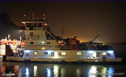
Louisville
Current StatusWhere is the vessel?
Louisville is currently in Near Kenova, based on AIS data received about 14h ago.
Latest AIS update:
Current position: 38.40142° N, 82.56460° W (Near Kenova)
Average speed (last 7 days): Loading…
Average speed (last 30 days): Loading…
Vessel profile: Louisville is a Service Ship with dimensions 17m x 300m.
This page combines live AIS, route history, probable destination signals, nearby traffic, and port activity for practical vessel monitoring.
The current position of vessel Louisville is 38.40142 lat / -82.56460 lng. Updated: 2026-05-20 16:41:41 UTCNearest reference points:
- Near Kenova
- Near Hitchins
- Near Rand
Details:
Live Vessel Louisville Analytics (details, animations, etc.)
Recent AIS points (UTC):
2026-05-20 13:29:13 UTC · 38.42403, -82.59920 · SOG 0 kn · COG -1°2026-05-20 13:51:33 UTC · 38.42448, -82.59888 · SOG 3.1 kn · COG -1°
2026-05-20 16:23:22 UTC · 38.40142, -82.56457 · SOG 0 kn · COG -1°
2026-05-20 16:41:41 UTC · 38.40142, -82.56460 · SOG 0 kn · COG -1°