 vesseltracker.com
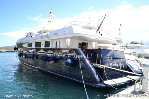
 SOPHIE BLUE
Current Status
Where is the vessel?
SOPHIE BLUE is currently in Near Palma, based on AIS data received about 14h ago.
Latest AIS update:
Current position: 39.56008° N, 2.63007° E (Near Palma)
Average speed (last 7 days): Loading…
Average speed (last 30 days): Loading…
Vessel profile: SOPHIE BLUE is a Yacht with dimensions m x m.
This page combines live AIS, route history, probable destination signals, nearby traffic, and port activity for practical vessel monitoring.
The current position of vessel SOPHIE BLUE is 39.56008 lat / 2.63007 lng. Updated: 2026-05-18 11:54:41 UTCNearest reference points:
- Near Palma
- Near PALMA DE MALLORCA
- Near PORTALS NOUS
Currently sailing under the flag of Malta ![]()
Details:
Live Vessel SOPHIE BLUE Analytics (details, animations, etc.)
Recent AIS points (UTC):
2026-05-18 07:48:59 UTC · 39.56008, 2.63007 · SOG 0 kn · COG 83°2026-05-18 09:49:01 UTC · 39.56009, 2.63006 · SOG 0 kn · COG 88°
2026-05-18 10:48:33 UTC · 39.56009, 2.63007 · SOG 0 kn · COG 86°
2026-05-18 11:54:41 UTC · 39.56008, 2.63007 · SOG 0 kn · COG -1°