 vesseltracker.com
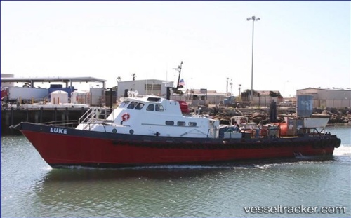
Luke
Current StatusWhere is the vessel?
Luke is currently in Near Sunset Beach, based on AIS data received about 14h ago.
Latest AIS update:
Current position: 33.63798° N, 118.18622° W (Near Sunset Beach)
Average speed (last 7 days): Loading…
Average speed (last 30 days): Loading…
Vessel profile: Luke is a Offshore Tug Supply Ship with dimensions 8m x 31m.
This page combines live AIS, route history, probable destination signals, nearby traffic, and port activity for practical vessel monitoring.
The current position of vessel Luke is 33.63798 lat / -118.18622 lng. Updated: 2026-05-17 22:19:55 UTCNearest reference points:
- Near Long Beach
- Near Los Angeles
- Near Seal Beach
Details:
Live Vessel Luke Analytics (details, animations, etc.)
Recent AIS points (UTC):
2026-05-17 18:12:34 UTC · 33.73500, -118.27077 · SOG 0 kn · COG 183°2026-05-17 19:56:43 UTC · 33.73502, -118.27076 · SOG 0 kn · COG 183°
2026-05-17 19:59:54 UTC · 33.73502, -118.27075 · SOG 0 kn · COG 182°
2026-05-17 22:19:55 UTC · 33.63798, -118.18622 · SOG 14.7 kn · COG 130°