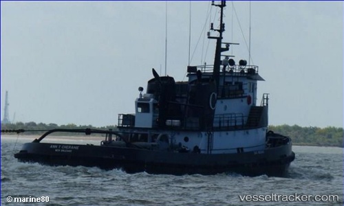
 Ann T Cheramie
Current Status
Where is the vessel?
Ann T Cheramie is currently in 51 nm SE of Jakolof Bay, based on AIS data received about 15h ago.
Latest AIS update:
Current position: 58.73320° N, 150.65939° W (51 nm SE of Jakolof Bay)
Average speed (last 7 days): Loading…
Average speed (last 30 days): Loading…
Vessel profile: Ann T Cheramie is a Tug with dimensions 35m x 10m.
This page combines live AIS, route history, probable destination signals, nearby traffic, and port activity for practical vessel monitoring.
The current position of vessel Ann T Cheramie is 58.73320 lat / -150.65939 lng. Updated: 2026-05-19 06:13:39 UTCNearest reference points:
- Near Kodiak
- Near Whittier
Currently sailing under the flag of USA ![]()
Details:
Live Vessel Ann T Cheramie Analytics (details, animations, etc.)
Recent AIS points (UTC):
2026-05-19 01:38:37 UTC · 58.21283, -151.43352 · SOG 8.2 kn · COG 37°2026-05-19 04:09:26 UTC · 58.49394, -151.00803 · SOG 9.1 kn · COG 30°
2026-05-19 05:00:22 UTC · 58.59167, -150.85667 · SOG 8 kn · COG -1°
2026-05-19 06:13:39 UTC · 58.73320, -150.65939 · SOG 8.4 kn · COG 31°