 FORTITUDE
Current Status
Where is the vessel?
FORTITUDE is currently in Near Oulu (Uleåborg), based on AIS data received about 14h ago.
Latest AIS update:
Current position: 65.00415° N, 25.42340° E (Near Oulu (Uleåborg))
Average speed (last 7 days): Loading…
Average speed (last 30 days): Loading…
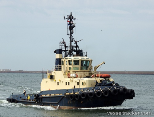
Vessel profile: FORTITUDE is a Tug with dimensions m x m.
This page combines live AIS, route history, probable destination signals, nearby traffic, and port activity for practical vessel monitoring.
The current position of vessel FORTITUDE is 65.00415 lat / 25.42340 lng. Updated: 2026-05-20 11:35:57 UTCNearest reference points:
- Near Karlsborg Axelvik
Currently sailing under the flag of Finland ![]()
Details:
Live Vessel FORTITUDE Analytics (details, animations, etc.)
Recent AIS points (UTC):
2026-05-20 08:14:57 UTC · 65.00413, 25.42345 · SOG 0 kn · COG 226°2026-05-20 10:11:56 UTC · 65.00413, 25.42340 · SOG 0 kn · COG 227°
2026-05-20 10:17:56 UTC · 65.00414, 25.42346 · SOG 0 kn · COG 226°
2026-05-20 11:35:57 UTC · 65.00415, 25.42340 · SOG 0 kn · COG 227°