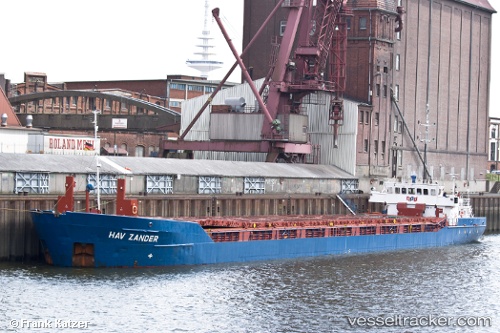
Hav Zander
Current StatusWhere is the vessel?
Hav Zander is currently in 36 nm W of Setubal, based on AIS data received about 15h ago.
Latest AIS update:
Current position: 38.47333° N, 8.22833° E (36 nm W of Setubal)
Average speed (last 7 days): Loading…
Average speed (last 30 days): Loading…
Vessel profile: Hav Zander is a Multi Purpose Carrier with dimensions 12m x 88m.
This page combines live AIS, route history, probable destination signals, nearby traffic, and port activity for practical vessel monitoring.
The current position of vessel Hav Zander is 38.47333 lat / 8.22833 lng. Updated: 2026-07-30 05:22:34 UTCNearest reference points:
- Near CARLOFORTE
- 35 nm S of Setubal
- Near SARROCH
Details:
Live Vessel Hav Zander Analytics (details, animations, etc.)
Recent AIS points (UTC):
2026-07-30 02:49:47 UTC · 38.50135, 8.63163 · SOG 7.3 kn · COG 266°2026-07-30 04:11:58 UTC · 38.49168, 8.41820 · SOG 7.5 kn · COG 264°
2026-07-30 04:15:58 UTC · 38.49063, 8.40783 · SOG 7.5 kn · COG 263°
2026-07-30 05:22:34 UTC · 38.47333, 8.22833 · SOG 7 kn · COG -1°