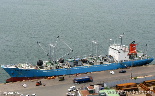
Houta Maru
Current StatusWhere is the vessel?
Houta Maru is currently in Open sea (no nearby ports in database), based on AIS data received about 14h ago.
Latest AIS update:
Current position: 32.95997° S, 88.89235° E (Open sea (no nearby ports in database))
Average speed (last 7 days): Loading…
Average speed (last 30 days): Loading…
Vessel profile: Houta Maru is a Refrigerated Cargo Ship with dimensions 15m x 106m.
This page combines live AIS, route history, probable destination signals, nearby traffic, and port activity for practical vessel monitoring.
The current position of vessel Houta Maru is -32.95997 lat / 88.89235 lng. Updated: 2026-05-20 16:18:32 UTCNearest reference points:
- Open sea (no nearby ports in database)
Details:
Live Vessel Houta Maru Analytics (details, animations, etc.)
Recent AIS points (UTC):
2026-05-20 11:33:59 UTC · -32.98462, 88.86557 · SOG 0.6 kn · COG 116°2026-05-20 13:16:18 UTC · -32.96923, 88.86840 · SOG 0.7 kn · COG 78°
2026-05-20 13:59:48 UTC · -32.96462, 88.87215 · SOG 0.2 kn · COG 108°
2026-05-20 16:18:32 UTC · -32.95997, 88.89235 · SOG 0.4 kn · COG 120°