 ORIS
ORIS
Current Status
Where is the vessel?
ORIS is currently in Near Gamcheon/Busan, based on AIS data received about 14h ago.
Latest AIS update:
Current position: 35.05365° N, 129.04095° E (Near Gamcheon/Busan)
Average speed (last 7 days): Loading…
Average speed (last 30 days): Loading…
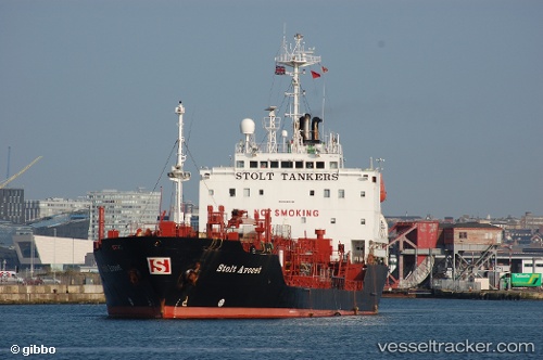
Vessel profile: ORIS is a Chemical Oil Products Tanker with dimensions 103m x 17m.
This page combines live AIS, route history, probable destination signals, nearby traffic, and port activity for practical vessel monitoring.
The current position of vessel ORIS is 35.05365 lat / 129.04095 lng. Updated: 2026-06-13 08:16:53 UTCNearest reference points:
- Near Gamcheon/Busan
- Near Busan
- Near BUSAN NEW PORT
Currently sailing under the flag of Togo ![]()
Details:
Live Vessel ORIS Analytics (details, animations, etc.)
Recent AIS points (UTC):
2026-06-13 05:04:55 UTC · 35.05378, 129.03987 · SOG 0 kn · COG 155°2026-06-13 05:31:51 UTC · 35.05345, 129.03940 · SOG 0 kn · COG 115°
2026-06-13 08:10:52 UTC · 35.05360, 129.04092 · SOG 0 kn · COG 234°
2026-06-13 08:16:53 UTC · 35.05365, 129.04095 · SOG 0 kn · COG 235°