 vesseltracker.com
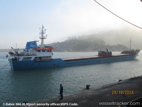
 Kaptan Cevdet
Current Status
Where is the vessel?
Kaptan Cevdet is currently in Near KORFEZ, based on AIS data received less than 1h ago.
Latest AIS update:
Current position: 40.75893° N, 29.75274° E (Near KORFEZ)
Average speed (last 7 days): Loading…
Average speed (last 30 days): Loading…
Vessel profile: Kaptan Cevdet is a General Cargo Ship with dimensions 81m x 11m.
This page combines live AIS, route history, probable destination signals, nearby traffic, and port activity for practical vessel monitoring.
The current position of vessel Kaptan Cevdet is 40.75893 lat / 29.75274 lng. Updated: 2026-05-16 05:46:04 UTCNearest reference points:
- Near KORFEZ
- Near YARIMCA
- Near Derince
Currently sailing under the flag of Turkey ![]()
Kaptan Cevdet built in 1992 year
Deadweight:
2298 tDetails:
Live Vessel Kaptan Cevdet Analytics (details, animations, etc.)
Recent AIS points (UTC):
2026-05-16 01:57:54 UTC · 40.75890, 29.75273 · SOG 0 kn · COG 323°2026-05-16 03:33:58 UTC · 40.75893, 29.75271 · SOG 0 kn · COG 322°
2026-05-16 04:12:59 UTC · 40.75891, 29.75273 · SOG 0 kn · COG 322°
2026-05-16 05:46:04 UTC · 40.75893, 29.75274 · SOG 0 kn · COG 323°