 vesseltracker.com
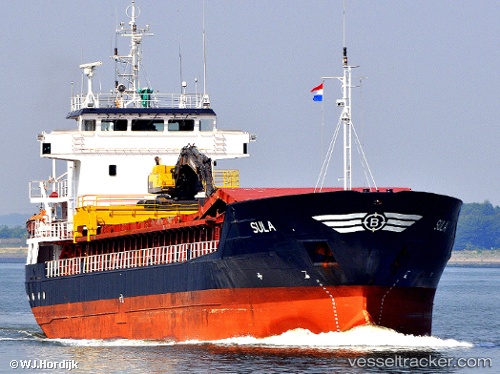
 Sula
Sula
Current Status
Where is the vessel?
Sula is currently in Near ROOMASSAARE, based on AIS data received less than 1h ago.
Latest AIS update:
Current position: 58.21335° N, 22.50661° E (Near ROOMASSAARE)
Average speed (last 7 days): Loading…
Average speed (last 30 days): Loading…
Vessel profile: Sula is a Multi Purpose Carrier with dimensions 87m x 13m.
This page combines live AIS, route history, probable destination signals, nearby traffic, and port activity for practical vessel monitoring.
The current position of vessel Sula is 58.21335 lat / 22.50661 lng. Updated: 2026-05-12 22:13:21 UTCNearest reference points:
- 18 nm N of Ventspils
- 11 nm N of Ventspils
- Near Ventspils
Currently sailing under the flag of Norway ![]()
Sula built in 1992 year
Deadweight:
3713 tDetails:
Live Vessel Sula Analytics (details, animations, etc.)
Recent AIS points (UTC):
2026-05-12 17:45:28 UTC · 58.10897, 22.40598 · SOG 10.7 kn · COG 13°2026-05-12 19:43:16 UTC · 58.21337, 22.50663 · SOG 0 kn · COG 81°
2026-05-12 19:52:19 UTC · 58.21337, 22.50662 · SOG 0 kn · COG 81°
2026-05-12 22:13:21 UTC · 58.21335, 22.50661 · SOG 0 kn · COG 81°