 YONG SHUN
Current Status
Where is the vessel?
YONG SHUN is currently in 76 nm E of 'Adan, based on AIS data received about 14h ago.
Latest AIS update:
Current position: 12.37352° N, 46.25941° E (76 nm E of 'Adan)
Average speed (last 7 days): Loading…
Average speed (last 30 days): Loading…
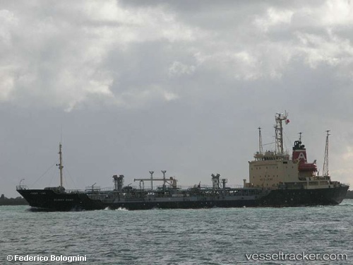
Vessel profile: YONG SHUN is a Oil/Chemical Tanker with dimensions m x m.
This page combines live AIS, route history, probable destination signals, nearby traffic, and port activity for practical vessel monitoring.
The current position of vessel YONG SHUN is 12.37352 lat / 46.25941 lng. Updated: 2026-05-19 23:18:01 UTCCurrently sailing under the flag of Comoros ![]()
Details:
Live Vessel YONG SHUN Analytics (details, animations, etc.)
Recent AIS points (UTC):
2026-05-19 19:08:44 UTC · 12.51389, 46.76020 · SOG 7.5 kn · COG -1°2026-05-19 21:56:53 UTC · 12.40761, 46.40850 · SOG 7.9 kn · COG -1°
2026-05-19 21:56:53 UTC · 12.40761, 46.40850 · SOG 7.9 kn · COG -1°
2026-05-19 23:18:01 UTC · 12.37352, 46.25941 · SOG 7.9 kn · COG -1°