 vesseltracker.com
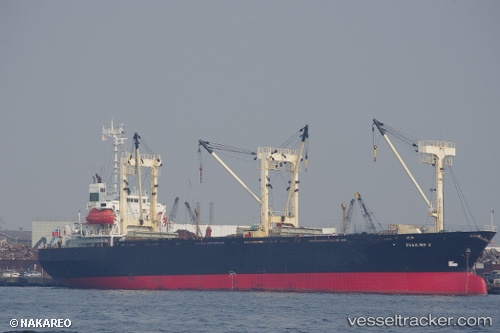
Khaled A
Current StatusWhere is the vessel?
Khaled A is currently in 39 nm SW of SHUAIBAH, based on AIS data received about 14h ago.
Latest AIS update:
Current position: 20.12930° N, 39.09900° E (39 nm SW of SHUAIBAH)
Average speed (last 7 days): Loading…
Average speed (last 30 days): Loading…
Vessel profile: Khaled A is a General Cargo Ship with dimensions 22m x 98m.
This page combines live AIS, route history, probable destination signals, nearby traffic, and port activity for practical vessel monitoring.
The current position of vessel Khaled A is 20.12930 lat / 39.09900 lng. Updated: 2026-05-18 13:31:45 UTCNearest reference points:
- 53 nm SW of SHUAIBAH
- 10 nm SW of Jeddah
- Near Jeddah
Details:
Live Vessel Khaled A Analytics (details, animations, etc.)
Recent AIS points (UTC):
2026-05-18 10:32:15 UTC · 19.83916, 39.25124 · SOG 6.5 kn · COG 330°2026-05-18 12:07:46 UTC · 19.99240, 39.16907 · SOG 6.6 kn · COG 333°
2026-05-18 13:13:56 UTC · 20.10086, 39.11494 · SOG 6.4 kn · COG 330°
2026-05-18 13:31:45 UTC · 20.12930, 39.09900 · SOG 6.2 kn · COG 332°