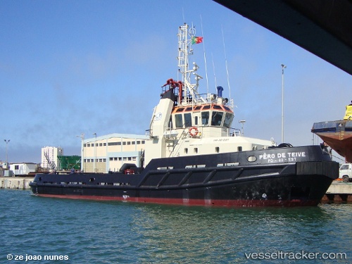
 Pero De Teive
Current Status
Where is the vessel?
Pero De Teive is currently in Near Ponta Delgada, based on AIS data received about 14h ago.
Latest AIS update:
Current position: 37.73528° N, 25.66886° W (Near Ponta Delgada)
Average speed (last 7 days): Loading…
Average speed (last 30 days): Loading…
Vessel profile: Pero De Teive is a Tug with dimensions 35m x 10m.
This page combines live AIS, route history, probable destination signals, nearby traffic, and port activity for practical vessel monitoring.
The current position of vessel Pero De Teive is 37.73528 lat / -25.66886 lng. Updated: 2026-05-23 20:15:06 UTCNearest reference points:
- Near Praia Da Vitoria
- 48 nm S of Villa Do Porto
- 81 nm SW of Matillas
Currently sailing under the flag of Portugal ![]()
Pero De Teive built in 1998 year
Details:
Live Vessel Pero De Teive Analytics (details, animations, etc.)
Recent AIS points (UTC):
2026-05-23 16:06:06 UTC · 37.73528, -25.66886 · SOG 0 kn · COG -1°2026-05-23 17:45:06 UTC · 37.73529, -25.66887 · SOG 0.1 kn · COG -1°
2026-05-23 19:41:07 UTC · 37.73500, -25.66833 · SOG 0 kn · COG -1°
2026-05-23 20:15:06 UTC · 37.73528, -25.66886 · SOG 0.1 kn · COG -1°