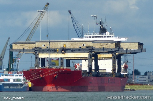
 SAGA CREST
Current Status
Where is the vessel?
SAGA CREST is currently in 16 nm SW of Madeira Beach, based on AIS data received about 15h ago.
Latest AIS update:
Current position: 27.63427° N, 83.04026° W (16 nm SW of Madeira Beach)
Average speed (last 7 days): Loading…
Average speed (last 30 days): Loading…
Vessel profile: SAGA CREST is a General Cargo with dimensions m x m.
This page combines live AIS, route history, probable destination signals, nearby traffic, and port activity for practical vessel monitoring.
The current position of vessel SAGA CREST is 27.63427 lat / -83.04026 lng. Updated: 2026-05-22 12:00:55 UTCNearest reference points:
- Near Tierra Verde
- Near Saint Pete Beach
- Near Saint Petersburg
Currently sailing under the flag of Bahamas ![]()
Details:
Live Vessel SAGA CREST Analytics (details, animations, etc.)
Recent AIS points (UTC):
2026-05-22 07:48:55 UTC · 27.63418, -83.04042 · SOG 0.1 kn · COG 144°2026-05-22 09:57:55 UTC · 27.63415, -83.04044 · SOG 0 kn · COG 144°
2026-05-22 10:15:55 UTC · 27.63409, -83.04049 · SOG 0.1 kn · COG 140°
2026-05-22 12:00:55 UTC · 27.63427, -83.04026 · SOG 0.1 kn · COG 150°