 vesseltracker.com
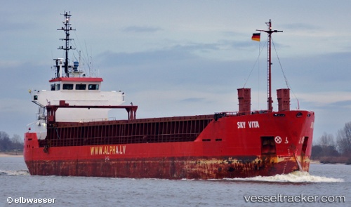
 SKY VISA
Current Status
Where is the vessel?
SKY VISA is currently in 22 nm W of Paxi, based on AIS data received about 3h ago.
Latest AIS update:
Current position: 39.07543° N, 19.74467° E (22 nm W of Paxi)
Average speed (last 7 days): Loading…
Average speed (last 30 days): Loading…
Vessel profile: SKY VISA is a General Cargo Ship with dimensions 13m x 88m.
This page combines live AIS, route history, probable destination signals, nearby traffic, and port activity for practical vessel monitoring.
The current position of vessel SKY VISA is 39.07543 lat / 19.74467 lng. Updated: 2026-05-17 22:28:03 UTCNearest reference points:
- 22 nm SW of Paxi
- Near Paxi
- Near Lefkímmi
Currently sailing under the flag of Panama ![]()
SKY VISA built in 1991 year
Deadweight:
4195 tDetails:
Live Vessel SKY VISA Analytics (details, animations, etc.)
Recent AIS points (UTC):
2026-05-17 20:10:04 UTC · 39.33383, 19.61943 · SOG 7 kn · COG 152°2026-05-17 21:37:34 UTC · 39.17045, 19.69884 · SOG 7.2 kn · COG 152°
2026-05-17 22:28:03 UTC · 39.07543, 19.74467 · SOG 7.1 kn · COG 151°
2026-05-17 22:28:03 UTC · 39.07543, 19.74467 · SOG 7.1 kn · COG 151°