 Nany
Nany
Current Status
Where is the vessel?
Nany is currently in Near La Plata, based on AIS data received about 14h ago.
Latest AIS update:
Current position: 34.73222° S, 57.85788° W (Near La Plata)
Average speed (last 7 days): Loading…
Average speed (last 30 days): Loading…
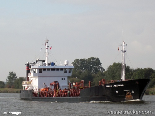
Vessel profile: Nany is a Chemical Oil Products Tanker with dimensions 84m x 14m.
This page combines live AIS, route history, probable destination signals, nearby traffic, and port activity for practical vessel monitoring.
The current position of vessel Nany is -34.73222 lat / -57.85788 lng. Updated: 2026-06-13 04:09:45 UTCNearest reference points:
- Near Dock Sur
- Near Avellaneda
- Near JUAN LACAZE
Currently sailing under the flag of Argentina ![]()
Nany built in 1994 year
Deadweight:
3294 tDetails:
Live Vessel Nany Analytics (details, animations, etc.)
Recent AIS points (UTC):
2026-06-13 01:47:05 UTC · -34.73153, -57.85704 · SOG 0.1 kn · COG 318°2026-06-13 02:16:25 UTC · -34.73157, -57.85700 · SOG 0 kn · COG 321°
2026-06-13 03:29:05 UTC · -34.73199, -57.85735 · SOG 0.1 kn · COG 338°
2026-06-13 04:09:45 UTC · -34.73222, -57.85788 · SOG 0.1 kn · COG 352°