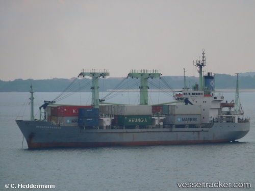
Meratus Sabang
Current StatusWhere is the vessel?
Meratus Sabang is currently in Near Taboneo, based on AIS data received about 14h ago.
Latest AIS update:
Current position: 3.69590° S, 114.44164° E (Near Taboneo)
Average speed (last 7 days): Loading…
Average speed (last 30 days): Loading…
Vessel profile: Meratus Sabang is a General Cargo Ship with dimensions 16m x 98m.
This page combines live AIS, route history, probable destination signals, nearby traffic, and port activity for practical vessel monitoring.
The current position of vessel Meratus Sabang is -3.69590 lat / 114.44164 lng. Updated: 2026-05-20 15:58:09 UTCNearest reference points:
- Near Taboneo
- Near BANJARMASIN
- Near Bunati
Details:
Live Vessel Meratus Sabang Analytics (details, animations, etc.)
Recent AIS points (UTC):
2026-05-20 11:51:31 UTC · -3.95167, 114.35667 · SOG 5 kn · COG -1°2026-05-20 13:09:27 UTC · -3.83667, 114.40833 · SOG 5 kn · COG -1°
2026-05-20 14:32:02 UTC · -3.71167, 114.43890 · SOG 4.4 kn · COG 5°
2026-05-20 15:58:09 UTC · -3.69590, 114.44164 · SOG 0 kn · COG 72°