 vesseltracker.com
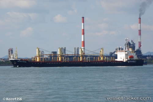
 TAE PHYONG
Current Status
Where is the vessel?
TAE PHYONG is currently in 32 nm SE of Beijiao, based on AIS data received about 1h ago.
Latest AIS update:
Current position: 26.00861° N, 120.36121° E (32 nm SE of Beijiao)
Average speed (last 7 days): Loading…
Average speed (last 30 days): Loading…
Vessel profile: TAE PHYONG is a Bulk Carrier with dimensions 177m x 28m.
This page combines live AIS, route history, probable destination signals, nearby traffic, and port activity for practical vessel monitoring.
The current position of vessel TAE PHYONG is 26.00861 lat / 120.36121 lng. Updated: 2026-05-14 10:34:06 UTCNearest reference points:
- 35 nm E of Beijiao
- 31 nm E of Beijiao
- 17 nm S of Beijiao
Currently sailing under the flag of Korea Democratic Republic ![]()
TAE PHYONG built in 1991 year
Deadweight:
26369 tDetails:
Live Vessel TAE PHYONG Analytics (details, animations, etc.)
Recent AIS points (UTC):
2026-05-14 05:46:25 UTC · 26.00833, 120.36333 · SOG 0 kn · COG -1°2026-05-14 10:28:07 UTC · 26.00877, 120.36125 · SOG 0.2 kn · COG 26°
2026-05-14 10:34:06 UTC · 26.00861, 120.36121 · SOG 0 kn · COG 26°
2026-05-14 10:34:06 UTC · 26.00861, 120.36121 · SOG 0 kn · COG 26°