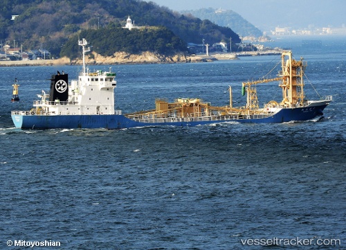
Homanzan
Current StatusWhere is the vessel?
Homanzan is currently in Near Handil, based on AIS data received about 14h ago.
Latest AIS update:
Current position: 0.68380° S, 117.30408° E (Near Handil)
Average speed (last 7 days): Loading…
Average speed (last 30 days): Loading…
Vessel profile: Homanzan is a Cement Carrier with dimensions 13m x 84m.
This page combines live AIS, route history, probable destination signals, nearby traffic, and port activity for practical vessel monitoring.
The current position of vessel Homanzan is -0.68380 lat / 117.30408 lng. Updated: 2026-05-21 00:38:06 UTCNearest reference points:
- 11 nm E of SAMARINDA
- Near SAMARINDA
- Near Handil
Details:
Live Vessel Homanzan Analytics (details, animations, etc.)
Recent AIS points (UTC):
2026-05-20 22:26:06 UTC · -0.55892, 117.17720 · SOG 0 kn · COG 310°2026-05-21 00:01:06 UTC · -0.60905, 117.29983 · SOG 7.2 kn · COG 169°
2026-05-21 00:38:06 UTC · -0.68380, 117.30408 · SOG 7.2 kn · COG 193°
2026-05-21 00:38:06 UTC · -0.68380, 117.30408 · SOG 7.2 kn · COG 193°