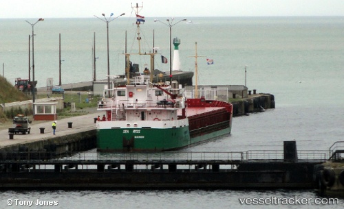
 Sea Riss
Current Status
Where is the vessel?
Sea Riss is currently in Near Butterwick, based on AIS data received about 14h ago.
Latest AIS update:
Current position: 52.96930° N, 0.01960° W (Near Butterwick)
Average speed (last 7 days): Loading…
Average speed (last 30 days): Loading…
Vessel profile: Sea Riss is a General Cargo Ship with dimensions 80m x 80m.
This page combines live AIS, route history, probable destination signals, nearby traffic, and port activity for practical vessel monitoring.
The current position of vessel Sea Riss is 52.96930 lat / -0.01960 lng. Updated: 2026-06-11 10:16:02 UTCNearest reference points:
- Near Grimsby
- Near Immingham
- Near Hull
Currently sailing under the flag of Netherlands ![]()
Sea Riss built in 1992 year
Deadweight:
2200 tDetails:
Live Vessel Sea Riss Analytics (details, animations, etc.)
Recent AIS points (UTC):
2026-06-11 07:21:37 UTC · 52.96938, -0.01972 · SOG 0 kn · COG 203°2026-06-11 07:47:13 UTC · 52.96935, -0.01976 · SOG 0 kn · COG 203°
2026-06-11 10:05:49 UTC · 52.96937, -0.01975 · SOG 0 kn · COG 203°
2026-06-11 10:16:02 UTC · 52.96930, -0.01960 · SOG 0.4 kn · COG 207°