 ATLANTIS 2
Current Status
Where is the vessel?
ATLANTIS 2 is currently in Near BOCA CHIKA, based on AIS data received about 15h ago.
Latest AIS update:
Current position: 18.44167° N, 69.62833° W (Near BOCA CHIKA)
Average speed (last 7 days): Loading…
Average speed (last 30 days): Loading…
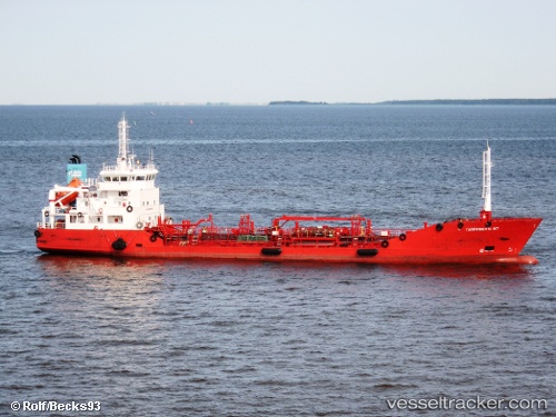
Vessel profile: ATLANTIS 2 is a Oil Products Tanker with dimensions m x m.
This page combines live AIS, route history, probable destination signals, nearby traffic, and port activity for practical vessel monitoring.
The current position of vessel ATLANTIS 2 is 18.44167 lat / -69.62833 lng. Updated: 2026-06-23 13:43:16 UTCNearest reference points:
- Near CASA DE CAMPO
- Near Bahia De Las Calderas
- 32 nm N of Punta Cana Apt
Currently sailing under the flag of Dominican Republic ![]()
Details:
Live Vessel ATLANTIS 2 Analytics (details, animations, etc.)
Recent AIS points (UTC):
2026-06-23 10:49:17 UTC · 18.44167, -69.62833 · SOG 0 kn · COG -1°2026-06-23 11:25:15 UTC · 18.44167, -69.62833 · SOG 0 kn · COG -1°
2026-06-23 13:10:16 UTC · 18.44167, -69.62833 · SOG 0 kn · COG -1°
2026-06-23 13:43:16 UTC · 18.44167, -69.62833 · SOG 0 kn · COG -1°