 AMAL
AMAL
Current Status
Where is the vessel?
AMAL is currently in 41 nm NE of SAFAGA, based on AIS data received about 15h ago.
Latest AIS update:
Current position: 27.05980° N, 34.63520° E (41 nm NE of SAFAGA)
Average speed (last 7 days): Loading…
Average speed (last 30 days): Loading…
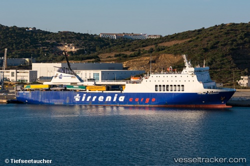
Vessel profile: AMAL is a Passenger/Ro-Ro Ship (vehicles) with dimensions 24m x 150m.
This page combines live AIS, route history, probable destination signals, nearby traffic, and port activity for practical vessel monitoring.
The current position of vessel AMAL is 27.05980 lat / 34.63520 lng. Updated: 2026-07-02 12:38:25 UTCNearest reference points:
- Near Bur Safaga
- 15 nm SW of Al Khuraibah
- 19 nm SE of Zeit Bay
Currently sailing under the flag of Cyprus ![]()
AMAL built in 1993 year
Deadweight:
7330 tDetails:
Live Vessel AMAL Analytics (details, animations, etc.)
Recent AIS points (UTC):
2026-07-02 10:48:15 UTC · 27.05980, 34.63520 · SOG 10.5 kn · COG 46°2026-07-02 11:55:28 UTC · 27.05980, 34.63520 · SOG 10.5 kn · COG 46°
2026-07-02 12:38:25 UTC · 27.05980, 34.63520 · SOG 10.5 kn · COG 46°
2026-07-02 12:38:25 UTC · 27.05980, 34.63520 · SOG 10.5 kn · COG 46°