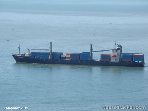
 Tanto Bersatu
Current Status
Where is the vessel?
Tanto Bersatu is currently in Near Karimun Besar Offshore, based on AIS data received about 14h ago.
Latest AIS update:
Current position: 1.14132° N, 103.44501° E (Near Karimun Besar Offshore)
Average speed (last 7 days): Loading…
Average speed (last 30 days): Loading…
Vessel profile: Tanto Bersatu is a Container Ship with dimensions m x m.
This page combines live AIS, route history, probable destination signals, nearby traffic, and port activity for practical vessel monitoring.
The current position of vessel Tanto Bersatu is 1.14132 lat / 103.44501 lng. Updated: 2026-05-22 04:20:59 UTCNearest reference points:
- Near Tanjungbalai
- Near Nipah
- Near Tuas
Currently sailing under the flag of Indonesia ![]()
Tanto Bersatu built in 1993 year
Deadweight:
22308 tDetails:
Live Vessel Tanto Bersatu Analytics (details, animations, etc.)
Recent AIS points (UTC):
2026-05-22 01:14:25 UTC · 0.61500, 103.73667 · SOG 12 kn · COG -1°2026-05-22 02:25:59 UTC · 0.79667, 103.59667 · SOG 13 kn · COG -1°
2026-05-22 04:18:25 UTC · 1.13618, 103.45091 · SOG 10.3 kn · COG -1°
2026-05-22 04:20:59 UTC · 1.14132, 103.44501 · SOG 10.3 kn · COG -1°