Ain Dar 7
Current StatusWhere is the vessel?
Ain Dar 7 is currently in 10 nm S of Bandar Al Mishab, based on AIS data received about 15h ago.
Latest AIS update:
Current position: 28.00500° N, 48.76833° E (10 nm S of Bandar Al Mishab)
Average speed (last 7 days): Loading…
Average speed (last 30 days): Loading…
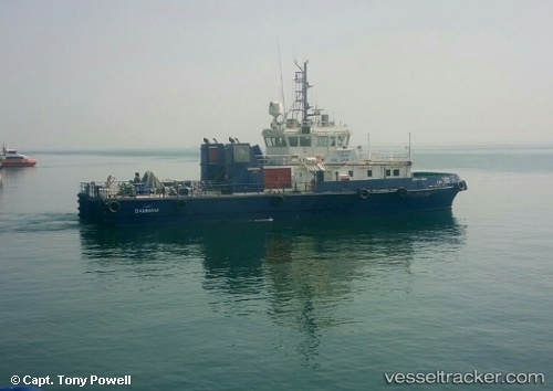
Vessel profile: Ain Dar 7 is a Pollution Control Vessel with dimensions 12m x 35m.
This page combines live AIS, route history, probable destination signals, nearby traffic, and port activity for practical vessel monitoring.
The current position of vessel Ain Dar 7 is 28.00500 lat / 48.76833 lng. Updated: 2026-05-20 21:22:08 UTCNearest reference points:
- Near Bandar Al Mishab
- Near KHAFJI
- 26 nm E of Bandar Al Mishab
Details:
Live Vessel Ain Dar 7 Analytics (details, animations, etc.)
Recent AIS points (UTC):
2026-05-20 14:37:48 UTC · 28.00592, 48.76900 · SOG 0 kn · COG 101°2026-05-20 14:37:48 UTC · 28.00592, 48.76900 · SOG 0 kn · COG 101°
2026-05-20 19:33:50 UTC · 28.00587, 48.76898 · SOG 0.2 kn · COG 101°
2026-05-20 21:22:08 UTC · 28.00500, 48.76833 · SOG 0 kn · COG -1°