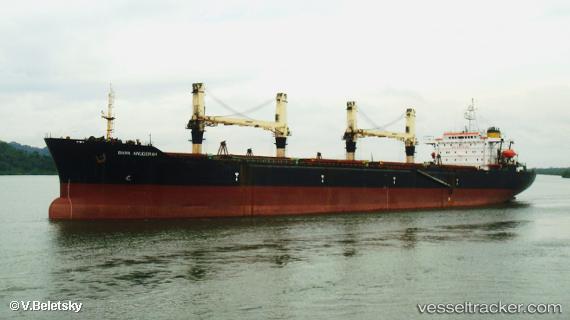
 Bara Anugerah
Current Status
Where is the vessel?
Bara Anugerah is currently in Near Taboneo, based on AIS data received about 28d ago.
Latest AIS update:
Current position: 3.72948° S, 114.45207° E (Near Taboneo)
Average speed (last 7 days): Loading…
Average speed (last 30 days): Loading…
Vessel profile: Bara Anugerah is a Bulk Carrier with dimensions 192m x 32m.
This page combines live AIS, route history, probable destination signals, nearby traffic, and port activity for practical vessel monitoring.
The current position of vessel Bara Anugerah is -3.72948 lat / 114.45207 lng. Updated: 2026-06-16 02:25:31 UTCNearest reference points:
- Near Taboneo
- Near BANJARMASIN
- Near Bunati
Currently sailing under the flag of Indonesia ![]()
Bara Anugerah built in 1994 year
Deadweight:
48131 tDetails:
Live Vessel Bara Anugerah Analytics (details, animations, etc.)
Recent AIS points (UTC):
2026-06-16 02:25:31 UTC · -3.72948, 114.45207 · SOG 7.9 kn · COG -1°