 Green Italia
Current Status
Where is the vessel?
Green Italia is currently in 63 nm E of Aras Asan/Bislig, based on AIS data received about 17h ago.
Latest AIS update:
Current position: 9.01789° N, 127.35472° E (63 nm E of Aras Asan/Bislig)
Average speed (last 7 days): Loading…
Average speed (last 30 days): Loading…
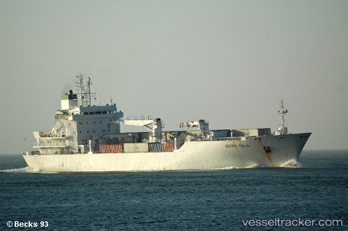
Vessel profile: Green Italia is a Refrigerated Cargo Ship with dimensions 130m x 20m.
This page combines live AIS, route history, probable destination signals, nearby traffic, and port activity for practical vessel monitoring.
The current position of vessel Green Italia is 9.01789 lat / 127.35472 lng. Updated: 2026-05-19 00:47:29 UTCNearest reference points:
- Near Taganito
- Near DICT / SVT
- Near Tacloban
Currently sailing under the flag of Bahamas ![]()
Green Italia built in 1994 year
Deadweight:
7721 tDetails:
Live Vessel Green Italia Analytics (details, animations, etc.)
Recent AIS points (UTC):
2026-05-19 00:47:29 UTC · 9.01789, 127.35472 · SOG 15.4 kn · COG 198°2026-05-19 00:47:29 UTC · 9.01789, 127.35472 · SOG 15.4 kn · COG 198°
2026-05-19 00:47:29 UTC · 9.01789, 127.35472 · SOG 15.4 kn · COG 198°
2026-05-19 00:47:29 UTC · 9.01789, 127.35472 · SOG 15.4 kn · COG 198°