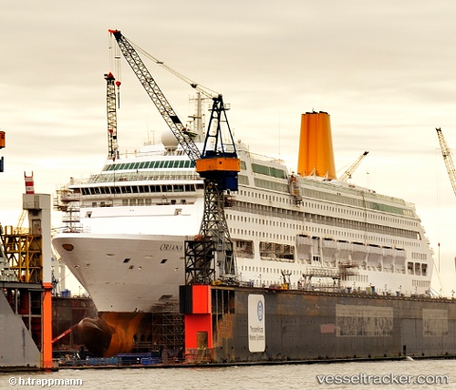
 Oriana
Current Status
Where is the vessel?
Oriana is currently in 15 nm S of Wan Tsai, based on AIS data received about 14h ago.
Latest AIS update:
Current position: 21.91832° N, 114.24896° E (15 nm S of Wan Tsai)
Average speed (last 7 days): Loading…
Average speed (last 30 days): Loading…
Vessel profile: Oriana is a Cruise Ship with dimensions 261m x 36m.
This page combines live AIS, route history, probable destination signals, nearby traffic, and port activity for practical vessel monitoring.
The current position of vessel Oriana is 21.91832 lat / 114.24896 lng. Updated: 2026-06-14 19:44:11 UTCNearest reference points:
- Near WAILINGDING ISLAND
- Near Pok Fu Lam
- 15 nm S of WAILINGDING ISLAND
Currently sailing under the flag of Bermuda ![]()
Oriana built in 1995 year
Deadweight:
6260 tDetails:
Live Vessel Oriana Analytics (details, animations, etc.)
Recent AIS points (UTC):
2026-06-14 16:35:08 UTC · 21.91854, 114.24885 · SOG 0.1 kn · COG 253°2026-06-14 18:20:09 UTC · 21.91824, 114.24905 · SOG 0.1 kn · COG 243°
2026-06-14 19:30:16 UTC · 21.91833, 114.24833 · SOG 0 kn · COG -1°
2026-06-14 19:44:11 UTC · 21.91832, 114.24896 · SOG 0.1 kn · COG 234°