Red Resource
Current StatusWhere is the vessel?
Red Resource is currently in Near Tanjung Perak, based on AIS data received about 14h ago.
Latest AIS update:
Current position: 7.20683° S, 112.73165° E (Near Tanjung Perak)
Average speed (last 7 days): Loading…
Average speed (last 30 days): Loading…
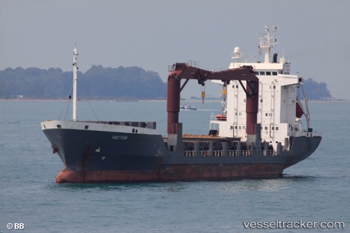
Vessel profile: Red Resource is a Multi Purpose Carrier with dimensions 16m x 100m.
This page combines live AIS, route history, probable destination signals, nearby traffic, and port activity for practical vessel monitoring.
The current position of vessel Red Resource is -7.20683 lat / 112.73165 lng. Updated: 2026-05-21 04:17:25 UTCNearest reference points:
- Near Tanjung Perak
- Near Kalianak Barat
- Near Tanjong Perak
Details:
Live Vessel Red Resource Analytics (details, animations, etc.)
Recent AIS points (UTC):
2026-05-21 01:51:18 UTC · -7.20482, 112.73032 · SOG 1.3 kn · COG 232°2026-05-21 02:32:27 UTC · -7.20680, 112.73164 · SOG 0 kn · COG 256°
2026-05-21 03:59:27 UTC · -7.20683, 112.73165 · SOG 0 kn · COG 256°
2026-05-21 04:17:25 UTC · -7.20683, 112.73165 · SOG 0 kn · COG 256°