 Kaijin
Current Status
Where is the vessel?
Kaijin is currently in 24 nm NW of Langsa Venture FPSO, based on AIS data received about 14h ago.
Latest AIS update:
Current position: 5.66833° N, 97.87500° E (24 nm NW of Langsa Venture FPSO)
Average speed (last 7 days): Loading…
Average speed (last 30 days): Loading…
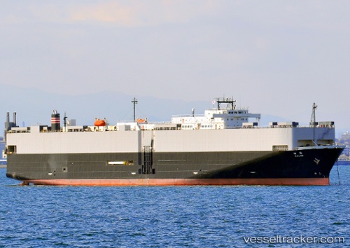
Vessel profile: Kaijin is a Vehicles Carrier with dimensions 196m x 28m.
This page combines live AIS, route history, probable destination signals, nearby traffic, and port activity for practical vessel monitoring.
The current position of vessel Kaijin is 5.66833 lat / 97.87500 lng. Updated: 2026-06-13 06:10:02 UTCNearest reference points:
- 34 nm N of Langsa Venture FPSO
- 45 nm N of Langsa Venture FPSO
- 18 nm E of Langsa Venture FPSO
Currently sailing under the flag of Panama ![]()
Kaijin built in 1994 year
Deadweight:
17183 tDetails:
Live Vessel Kaijin Analytics (details, animations, etc.)
Recent AIS points (UTC):
2026-06-13 02:00:32 UTC · 5.06655, 98.67889 · SOG 14 kn · COG -1°2026-06-13 03:22:01 UTC · 5.28667, 98.44333 · SOG 14 kn · COG -1°
2026-06-13 04:49:02 UTC · 5.53667, 98.18333 · SOG 15 kn · COG -1°
2026-06-13 06:10:02 UTC · 5.66833, 97.87500 · SOG 15 kn · COG -1°