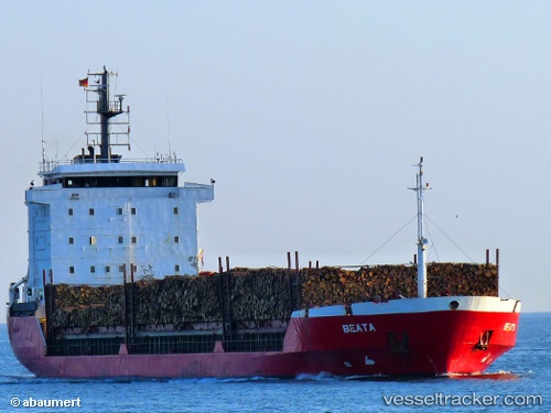
 Beata
Beata
Current Status
Where is the vessel?
Beata is currently in 17 nm N of Ventspils, based on AIS data received about 14h ago.
Latest AIS update:
Current position: 57.67043° N, 21.68663° E (17 nm N of Ventspils)
Average speed (last 7 days): Loading…
Average speed (last 30 days): Loading…
Vessel profile: Beata is a Multi Purpose Carrier with dimensions 107m x 18m.
This page combines live AIS, route history, probable destination signals, nearby traffic, and port activity for practical vessel monitoring.
The current position of vessel Beata is 57.67043 lat / 21.68663 lng. Updated: 2026-05-21 03:51:46 UTCNearest reference points:
- 18 nm N of Ventspils
- 11 nm N of Ventspils
- Near Ventspils
Currently sailing under the flag of Portugal ![]()
Beata built in 1994 year
Deadweight:
6918 tDetails:
Live Vessel Beata Analytics (details, animations, etc.)
Recent AIS points (UTC):
2026-05-21 00:19:37 UTC · 57.89062, 22.86714 · SOG 11.6 kn · COG 259°2026-05-21 01:02:09 UTC · 57.86263, 22.61767 · SOG 11.5 kn · COG 242°
2026-05-21 02:09:58 UTC · 57.76374, 22.25478 · SOG 11.5 kn · COG 243°
2026-05-21 03:51:46 UTC · 57.67043, 21.68663 · SOG 11.4 kn · COG 268°